Hi Readers,
Many thanks for all your encouragements and congratulations.
The end of the trip was both elating and a bit sad that the journey is over.
Thanks to all those that made this possible, it was a joint effort and I've put a sticker on the bike that says "We crossed the Nullarbor".
Friday, 18 November 2011

Wednesday, 16 November 2011

Day 22 Cunderdin - Chidlow 125km
Good tailwinds today. Even though the Great Eastern Highway - Route 94 - became wider and smoother, the trucks no longer moved over, especially when there was an overtaking lane. I was happy to be off that road and on the railtrail.
Camped near Chidlow at Lake Leschanaultia which was a beautiful place to camp.
The rail trail to Midland went through the John Forrest National Park, and was mostly downhill. It was a joy to scoot on that track than ride on the highway.
I set a new speed record of 49km/h downhill back on the highway.
Camped near Chidlow at Lake Leschanaultia which was a beautiful place to camp.
The rail trail to Midland went through the John Forrest National Park, and was mostly downhill. It was a joy to scoot on that track than ride on the highway.
I set a new speed record of 49km/h downhill back on the highway.
 | ||
| Peter who has been on the road for seven years! (Northam) |
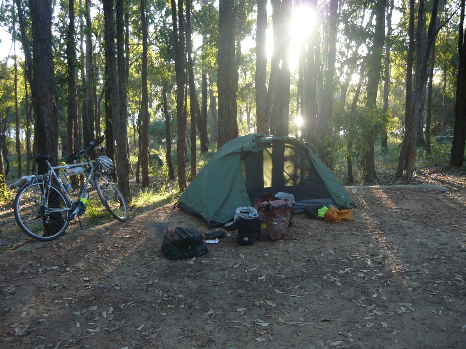 | ||
| Last night of camping at Lake Leschanaultia |
Monday, 14 November 2011
Day 21 Merredin to Cunderdin 108km
Hi,
Just a short message:
Headwinds, good road - wide and smooth.
Will ride from Cunderdin to Northam (56km) , then take the Kep bike track to Woroloo , then the Rail reserves heritage trail to Midland. I'll stay in Midland on the 15th, and make the final dash to the Indian Ocean on the 16th. Barring bottles.
http://www.railtrails.org.au/states/trails.php3?action=trail&trail=49
Rob.
Just a short message:
Headwinds, good road - wide and smooth.
Will ride from Cunderdin to Northam (56km) , then take the Kep bike track to Woroloo , then the Rail reserves heritage trail to Midland. I'll stay in Midland on the 15th, and make the final dash to the Indian Ocean on the 16th. Barring bottles.
http://www.railtrails.org.au/states/trails.php3?action=trail&trail=49
Rob.
Sunday, 13 November 2011
Day 20 Southern Cross to Merredin 110km
This was a heavy headwind day.
Route 94 deterioated for 75km out of Southern Cross, then the shoulder widened to become a bicycle autobahn. It was a hairy ride for that 75km, and had to constantly check the mirror and over my shoulder.
It seems that the W.A. term for a cyclist is an "anchor". This is what I was called with gusto by a passenger of a passing shiny utility that had a muffler problem. I don't understand the nautical connection, but will look it up later. He may have said the Nyoongar Aboriginal phrase "gnank-aarr" which means "my voice has broken and I will soon be a man!".
In any case I responded with a friendly bird-like wave and carried on my way.
To date the bike has been faultless. Here is a list of equipment failures to date:
1. bent kick-stand from being overloaded
2. suncream impregnated riding gloves that hold their shape.
3. slightly stretched brake cable from a heavy stop.
4. slightly scorched saucepan.
5. self-deflating Thermorest (tm) mattress.
Right now I am at Kelleberrin on route to Cunderdin, the second last stop.


Route 94 deterioated for 75km out of Southern Cross, then the shoulder widened to become a bicycle autobahn. It was a hairy ride for that 75km, and had to constantly check the mirror and over my shoulder.
It seems that the W.A. term for a cyclist is an "anchor". This is what I was called with gusto by a passenger of a passing shiny utility that had a muffler problem. I don't understand the nautical connection, but will look it up later. He may have said the Nyoongar Aboriginal phrase "gnank-aarr" which means "my voice has broken and I will soon be a man!".
In any case I responded with a friendly bird-like wave and carried on my way.
To date the bike has been faultless. Here is a list of equipment failures to date:
1. bent kick-stand from being overloaded
2. suncream impregnated riding gloves that hold their shape.
3. slightly stretched brake cable from a heavy stop.
4. slightly scorched saucepan.
5. self-deflating Thermorest (tm) mattress.
Right now I am at Kelleberrin on route to Cunderdin, the second last stop.

Remy from France

Rabbit Proof Fence near Merredin

More wildflowers

Hill near Norseman
Saturday, 12 November 2011
Day 19 Bush camp 4 (beyond Coolgardie) to Southern Cross 140km
The last two days have been getting hotter. Today it was about 30degrees.
Southern Cross marks the boundary from mining country to the wheat belt.
The last two days brought good tail winds, so I managed to gain a day.
The camera's memory stick to USB adaptor can't physically fit in the PC here, so I can't add photos to this entry. Pity, because there are many different types of wild flowers that I've photographed along the road side. Maybe I could add them tomorrow.
Route 94 isn't very suited for bicycles. The shoulder, if it exists, is too narrow and bumpy. The edge of the asphalt has a 5cm drop to the gravel. The gravel is bauxite, which is like riding on ball bearings. So, if any other cyclists are reading this blog for information on a suitable route - avoid 94. I've had a near slip and fall but was able to stop falling over.
Next stop is Merredin, but if the wind is good I may go further.
Southern Cross marks the boundary from mining country to the wheat belt.
The last two days brought good tail winds, so I managed to gain a day.
The camera's memory stick to USB adaptor can't physically fit in the PC here, so I can't add photos to this entry. Pity, because there are many different types of wild flowers that I've photographed along the road side. Maybe I could add them tomorrow.
Route 94 isn't very suited for bicycles. The shoulder, if it exists, is too narrow and bumpy. The edge of the asphalt has a 5cm drop to the gravel. The gravel is bauxite, which is like riding on ball bearings. So, if any other cyclists are reading this blog for information on a suitable route - avoid 94. I've had a near slip and fall but was able to stop falling over.
Next stop is Merredin, but if the wind is good I may go further.
Thursday, 10 November 2011
Day 18 Widgiemooltha to Coolgardie and beyond 125km
Hi All,
I have mixed up all the days and have just corrected them all.
Had a poor night sleep. The camping ground at Widgiemooltha was 50m from the loudest generator, underneath a light and about 20m from the highway. I turned off the light, but the owner came down an hour later and switched it on again.
I had an easy 76km ride to Coolgardie, most of it seemed to be downhill.
It's so good to be in a place where the buildings are made of brick and not tin or fibro cement. And there's an IGA! Whoo - civilization.
I forgot to mention the longest golf course in the world; the 1365km long Nullarbor links golf course. http://www.nullarborlinks.com/.
The road from Norseman to Coolgardie took a lot more concentration to ride since it is narrower, hillier and winds its way North. I had to pull over on the side many times when I could hear a truck coming. Also, the traffic is increasing. The trucks are gargantuan and carry gargantuan machinery that digs, drills and levels mountains. Most cars here have an orange light on their roof and most people wear fluoro vests. Yes - I'm in mining country.
Never mention taxing what's in the ground that rightfully belongs to China, or you'll be in for a fight!
The next link in the riding chain Westwards is the Boondi campgrounds 90km from here , then Southern Cross 100km further. I'm not sure if I'll make the campgrounds, but will see how far I can go in the next 4 hours.
At this rate I should be in Perth late on Nov 17.


I have mixed up all the days and have just corrected them all.
Had a poor night sleep. The camping ground at Widgiemooltha was 50m from the loudest generator, underneath a light and about 20m from the highway. I turned off the light, but the owner came down an hour later and switched it on again.
I had an easy 76km ride to Coolgardie, most of it seemed to be downhill.
It's so good to be in a place where the buildings are made of brick and not tin or fibro cement. And there's an IGA! Whoo - civilization.
I forgot to mention the longest golf course in the world; the 1365km long Nullarbor links golf course. http://www.nullarborlinks.com/.
The road from Norseman to Coolgardie took a lot more concentration to ride since it is narrower, hillier and winds its way North. I had to pull over on the side many times when I could hear a truck coming. Also, the traffic is increasing. The trucks are gargantuan and carry gargantuan machinery that digs, drills and levels mountains. Most cars here have an orange light on their roof and most people wear fluoro vests. Yes - I'm in mining country.
Never mention taxing what's in the ground that rightfully belongs to China, or you'll be in for a fight!
The next link in the riding chain Westwards is the Boondi campgrounds 90km from here , then Southern Cross 100km further. I'm not sure if I'll make the campgrounds, but will see how far I can go in the next 4 hours.
At this rate I should be in Perth late on Nov 17.

Wildflowers

Postcard from Cocklebidy.
Subscribe to:
Posts (Atom)